
File:Zi-map.png
Zi-map.png (344 × 368 pixels, file size: 12 KB, MIME type: image/png)
| |
This is a file from the Wikimedia Commons. Information from its description page there is shown below.
Commons is a freely licensed media file repository. You can help. |
Summary
| Description |
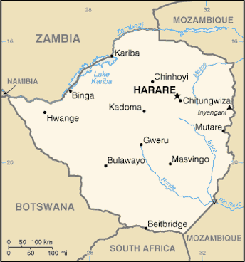
English: Zimbabwe map from CIA World Factbook, converted from original GIF format
|
| Date | 10 June 2005 |
| Source |
|
| Author | United States Central Intelligence Agency |
| Permission ( Reusing this file) |
Public domain |
Licensing
 |
This image is in the public domain because it contains materials that originally came from the United States Central Intelligence Agency's World Factbook.
|
 |
File usage
The following pages on Schools Wikipedia link to this image (list may be incomplete):
Schools Wikipedia facts
All five editions of Schools Wikipedia were compiled by SOS Childrens Villages. Thanks to SOS Childrens Villages, 62,000 children are enjoying a happy childhood, with a healthy, prosperous future ahead of them. Why not try to find out more about sponsoring a child?