
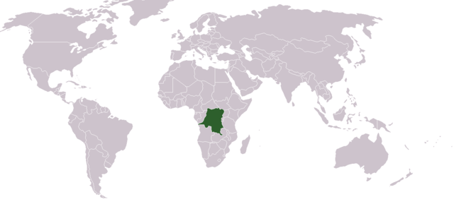
File:LocationDRCongo.png
Size of this preview: 640 × 296 pixels.
| |
This is a file from the Wikimedia Commons. Information from its description page there is shown below.
Commons is a freely licensed media file repository. You can help. |
| Description |
English: Location map for the Demoratic Republic of the Congo
Français : Carte de localisation de la République démocratique du Congo
|
| Date | 12 December 2004 |
| Source | Own work |
| Author | Dbenbenn from image "BlakMap-Worl" (doesn't exist any more on wikipedia) created by Vardion |
 |
This work has been released into the public domain by its author, Vardion at the English Wikipedia project. This applies worldwide. In case this is not legally possible: |
 |
File:LocationDRCongo.svg is a vector version of this file. It should be used in place of this raster image when superior. File:LocationDRCongo.png
For more information about vector graphics, read about Commons transition to SVG.
|
 |
File usage
The following pages on Schools Wikipedia link to this image (list may be incomplete):
Want to know more?
You can learn about nearly 6,000 different topics on Schools Wikipedia. SOS Children is famous for the love and shelter it brings to lone children, but we also support families in the areas around our Children's Villages, helping those who need us the most. Why not try to find out more about sponsoring a child?