
File:Manihiki.jpg
Size of this preview: 483 × 479 pixels.
| |
This is a file from the Wikimedia Commons. Information from its description page there is shown below.
Commons is a freely licensed media file repository. You can help. |
Summary
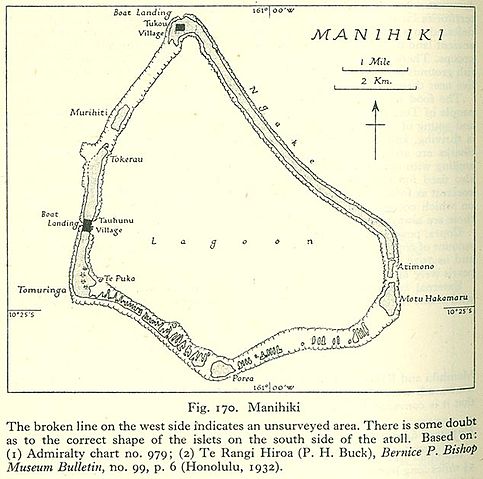
| Description | English: Map of Manihiki Atoll, Northern Cook Islands, Pacific Ocean
|
| Date | 1943 |
| Source | http://www.lib.utexas.edu/maps/historical/pacific_islands_1943_1945/manihiki.jpg |
| Author | US Army |
Licensing
 |
This image is a work of a U.S. Army soldier or employee, taken or made as part of that person's official duties. As a work of the U.S. federal government, the image is in the public domain.
|
 |
File usage
The following pages on Schools Wikipedia link to this image (list may be incomplete):
Metadata
Want to know more?
You can learn about nearly 6,000 different topics on Schools Wikipedia. In 133 nations around the world, SOS Childrens Villages works to bring better education and healthcare to families in desperate need of support. You can help by sponsoring a child.