
File:Brittain 410.jpg
| |
This is a file from the Wikimedia Commons. Information from its description page there is shown below.
Commons is a freely licensed media file repository. You can help. |
Summary
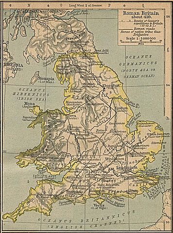
Map of the isle Great Britain in the year 410. Image comes from the University of Texas at Austin: http://geography.about.com/gi/dynamic/offsite.htm?site=http://www.lib.utexas.edu/maps/historical/history%5Feurope.html The work is from From The Historical Atlas by William R. Shepherd, 1926.
Map is released into the public Domain.
Licensing
 |
This image (or other media file) is in the public domain because its copyright has expired. This applies to Australia, the European Union and those countries with a copyright term of life of the author plus 70 years.
|
|
|
|
File usage
Want to know more?
Schools Wikipedia has been carefully checked to give you the best learning experience. SOS Children's Villages believes that a decent childhood is essential to a happy, healthy. Our community work brings families new opportunities through education, healthcare and all manner of support. We have helped children in Africa for many years - you can help too...