
File:Pacific-Ocean-Pitcairn-Island-on-globe-view-English.jpg
| |
This is a file from the Wikimedia Commons. Information from its description page there is shown below.
Commons is a freely licensed media file repository. You can help. |
Summary
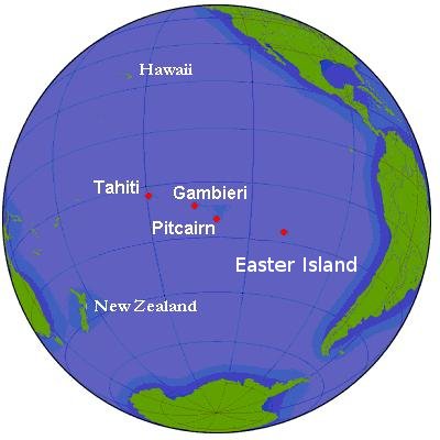
Simple map of globe, seen from area of Pitcairn Island and Tahiti. Ocean waters along continental shelves are shaded in darker hue. Parallels of latitude are at 20-degree intervals. Labels are in English.
Source URL (Wikimedia Commons): http://upload.wikimedia.org/wikipedia/commons/2/2c/Pitcairn.png (file downloaded, cropped, and re-labeled in larger font, as JPEG format, 10x times faster than PNG format).
This file, in JPEG-format, is intended for use in frequently-read articles (might display 20x times faster than larger PNG-format file, and with large, clear labels).
 |
This map image could be recreated using vector graphics as an SVG file. This has several advantages; see Commons:Media for cleanup for more information. If an SVG form of this image is already available, please upload it. After uploading an SVG, replace this template with {{ vector version available|new image name.svg}}. |
Licensing
|

File usage
Find out more
SOS Children chose the best bits of Wikipedia to help you learn. SOS Children is there for the children in our care until they are ready for independence. There are many ways to help with SOS Children's Villages.