
File:Sunda strait map v3.png
Size of this preview: 391 × 480 pixels.
| |
This is a file from the Wikimedia Commons. Information from its description page there is shown below.
Commons is a freely licensed media file repository. You can help. |
Summary
| Description |
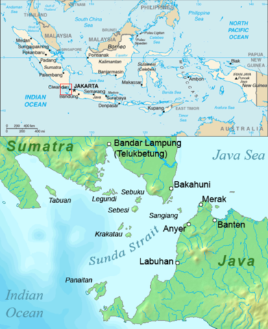
English: Map of the Sunda Strait, Indonesia.
|
|||||
| Date | 26 August 2006 | |||||
| Source | Combination of CIA World Factbook map and Demis Map Server ( http://www2.demis.nl/mapserver/mapper.asp) data with additional annotations and modifications by self. | |||||
| Author | ChrisO | |||||
| Permission ( Reusing this file) |
|


File usage
The following pages on Schools Wikipedia link to this image (list may be incomplete):
Learn more
SOS Children's Villages chose the best bits of Wikipedia to help you learn. SOS Children works in 133 countries and territories across the globe, helps more than 62,000 children, and reaches over 2 million people in total. There are many ways to help with SOS Children.