
File:Guernsey.png
Size of this preview: 523 × 479 pixels.
| |
This is a file from the Wikimedia Commons. Information from its description page there is shown below.
Commons is a freely licensed media file repository. You can help. |
 |
This map has been uploaded by Electionworld from en.wikipedia.org to enable the |
Summary
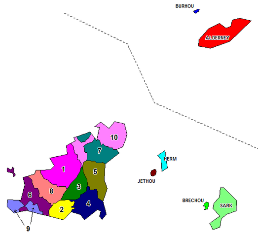
Map of the administrative divisions of the Bailiwick of Guernsey. Created by Rarelibra for public domain use. Created using MapInfo Professional v7.5 and various mapping resources.
Licensing
 |
I, the copyright holder of this work, release this work into the public domain. This applies worldwide. In some countries this may not be legally possible; if so: I grant anyone the right to use this work for any purpose, without any conditions, unless such conditions are required by law.
|
File usage
The following pages on Schools Wikipedia link to this image (list may be incomplete):
Wikipedia for Schools...
Through Schools Wikipedia, SOS Childrens Villages has brought learning to children around the world. SOS Childrens Villages believes education is an important part of a child's life. That's why we ensure they receive nursery care as well as high-quality primary and secondary education. When they leave school, we support the children in our care as they progress to vocational training or higher education. Sponsoring a child is a great way to help children who need your support.