
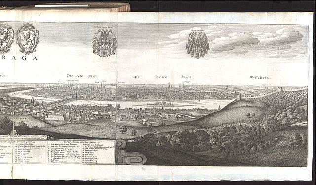
File:Bohemiae Moraviae et Silesiae (Merian) 102.jpg
Size of this preview: 640 × 375 pixels.
| |
This is a file from the Wikimedia Commons. Information from its description page there is shown below.
Commons is a freely licensed media file repository. You can help. |
<<< Previous Next >>>
| Author |
Martin Zeiller |
 |
|||||||||||||||||||
| Illustrator |
|
||||||||||||||||||||
| Title |
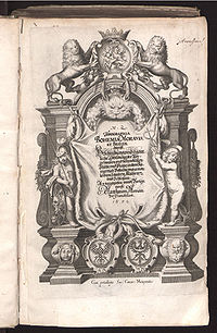
Topographia Bohemiae, Moraviae Et Silesiae. |
||||||||||||||||||||
| Subtitle |
das ist Beschreibung und eigentliche Abbildung der Vornehmsten und bekandtisten Stätte und Plätze, in dem Königreich Boheim und einverleibten Landern, Mähren, und Schlesien |
||||||||||||||||||||
| Series title |
Topographia Germaniae |
||||||||||||||||||||
| Volume |
11 |
||||||||||||||||||||
| Edition |
2 |
||||||||||||||||||||
| Publisher |
Matthäus Merian |
||||||||||||||||||||
| Year of publication |
1650 |
||||||||||||||||||||
| Place of publication |
Frankfurt am Main |
||||||||||||||||||||
| Language |
german |
||||||||||||||||||||
| Source |
digitized by: UB Düsseldorf |
||||||||||||||||||||
| Permission ( Reusing this file) |
|
||||||||||||||||||||


derivative works
Derivative works of this file:
File usage
The following pages on Schools Wikipedia link to this image (list may be incomplete):
Background information
Schools Wikipedia was created by children's charity SOS Children's Villages. SOS Childrens Villages helps more than 2 million people across 133 countries around the world. Will you help another child today?