 |
This is a file from the Wikimedia Commons. Information from its description page there is shown below.
Commons is a freely licensed media file repository. You can help.
|
Summary
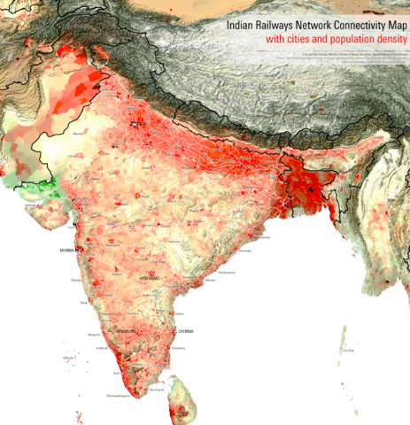
| DescriptionIndian Railways Network Connectivity Map with cities and population density.png |
English: Railway network connectivity map of the populated regions of India. The en:Indian Railways is the world's fourth largest railway network spread over 64,000 kms and transport 30 million passengers a day.
|
| Date |
10 September 2011 |
| Source |
Own work |
| Author |
Planemad |
Licensing
NATIONAL INSTITUTE OF DESIGN
Bangalore Campus
This is a work of a student or faculty from the National Institute of Design (India), 2013
|
CC-by-sa Arun Ganesh, National Institute of Design Bangalore
- all works are licensed under Creative Commons Share Alike 3.0 license and must be used with the mentioned credit line.
- all subsequent derivative works must be licensed under Creative Commons Share Alike 3.0
- in case of a custom license, please contact the author or the image uploader.
- for online use, a link back to this page must be provided
|
 The categories of this image should be checked. Check them now!
- Remove redundant categories and try to put this image in the most specific category/categories
- Remove this template by clicking here (or on the first line)
File usage on other wikis
Related galleries
File usage
The following pages on Schools Wikipedia link to this image (list may be incomplete):
SOS Childrens Villages aims to make Wikipedia suitable for young learners. In 133 nations around the world, SOS Children works to bring better education and healthcare to families in desperate need of support. Have you thought about sponsoring a child?


