
File:Map of Great Barrier Reef Demis.png
Size of this preview: 428 × 479 pixels.
| |
This is a file from the Wikimedia Commons. Information from its description page there is shown below.
Commons is a freely licensed media file repository. You can help. |
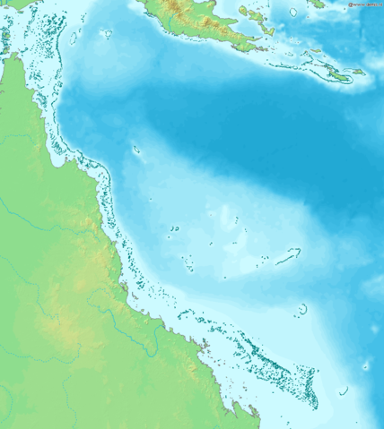
Map of Great Barrier Reef.
Bounding box West 142°, South -23°, East 155°, North -9°. Centre at 16°00′00″S 148°30′00″E / 16.00000°S 148.50000°E.
 |
This image is in the public domain because it came from the site http://www.demis.nl/home/pages/Gallery/examples.htm and was released by the copyright holder. Permission is granted to copy, distribute and/or modify this map since it is based on free of copyright images from: www.demis.nl. See also approval email on de.wp and its clarification.
|
File usage
The following pages on Schools Wikipedia link to this image (list may be incomplete):
Metadata
Want to know more?
Wikipedia for Schools is one of SOS Children's many educational projects. Our 500 Children's Villages provide a home for thousands of vulnerable children. Beyond our Villages, we support communities, helping local people establish better schools and delivering effective medical care to vulnerable children. If you'd like to help, why not learn how to sponsor a child?