
File:1928 Okeechobee Flood.png
Size of this preview: 501 × 480 pixels.
| |
This is a file from the Wikimedia Commons. Information from its description page there is shown below.
Commons is a freely licensed media file repository. You can help. |
| Description |
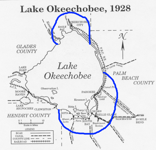
English: Map showing the area of the flood caused by the 1928 Okeechobee hurricane. Ironically, residents of Torry Island, on the south side of the lake, owe their survival to the resulting flood. Note: The Palm Beach County label is misplaced. North of Canal Point has been in Martin County since 1925.
|
| Date | 1928 |
| Source | From http://www.srh.noaa.gov/mfl/newpage/Okeechobee.htm. |
| Author | NOAA |
Licensing
 |
This image is in the public domain because it contains materials that originally came from the U.S. National Oceanic and Atmospheric Administration, taken or made as part of an employee's official duties.
|
 |
 |
This map image could be recreated using vector graphics as an SVG file. This has several advantages; see Commons:Media for cleanup for more information. If an SVG form of this image is already available, please upload it. After uploading an SVG, replace this template with {{ vector version available|new image name.svg}}. |
File usage
The following pages on Schools Wikipedia link to this image (list may be incomplete):
I want to learn more...
Wikipedia for Schools is designed to make learning fun and easy. SOS Children is a global charity founded in 1949 to give children who have lost everything the childhood they deserve. Try to find out how you can help children in other countries on our web site.