
File:Confluence of Rivers Thames and Brent - geograph.org.uk - 921332.jpg
Size of this preview: 628 × 480 pixels.
| |
This is a file from the Wikimedia Commons. Information from its description page there is shown below.
Commons is a freely licensed media file repository. You can help. |
Summary
| Description |
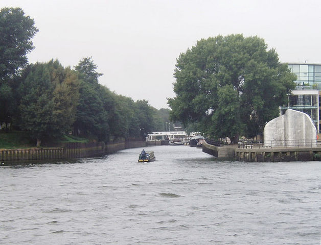
English: Confluence of Rivers Thames and Brent The motorised barge is heading up the River Brent. From this point as far as Hanwell the Brent has been canalised and shares its course with the main line of the Grand Union Canal. From Hanwell the Brent can be traced to various sources in the Barnet area.
|
| Date | 13 August 2008 |
| Source | From geograph.org.uk |
| Author | David Kemp |
|
Camera location |
|
This and other images at their locations on: Google Maps - Google Earth - OpenStreetMap | ( Info) |
|---|
Licensing
 |
This image was taken from the Geograph project collection. See this photograph's page on the Geograph website for the photographer's contact details. The copyright on this image is owned by David Kemp and is licensed for reuse under the Creative Commons Attribution-ShareAlike 2.0 license. |
| This file is licensed under the Creative Commons Attribution-Share Alike 2.0 Generic license. | ||
| Attribution: David Kemp | ||
|
File usage
The following pages on Schools Wikipedia link to this image (list may be incomplete):
Want to know more?
Through Schools Wikipedia, SOS Children has brought learning to children around the world. SOS Children's Villages is there for the children in our care until they are ready for independence. Sponsoring a child is the coolest way to help.