
File:How-Bogota-Streets-are-Numbered-and-Named.png
Size of this preview: 380 × 479 pixels.
| |
This is a file from the Wikimedia Commons. Information from its description page there is shown below.
Commons is a freely licensed media file repository. You can help. |
Summary
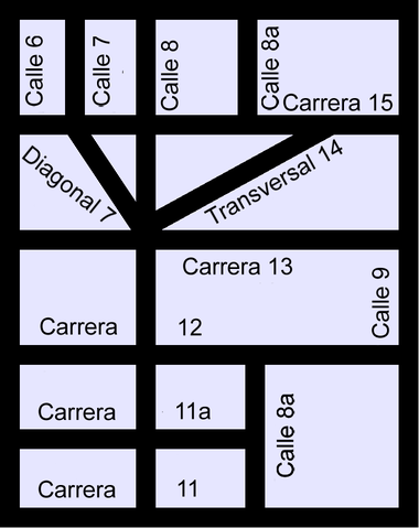
A diagram showing how Streets are named and numbered in the city of Bogotá.
Author: Elkin Fricke
Source: Selfdrawn
Date: 03.29.2006
Licensing
| This file is licensed under the Creative Commons Attribution-Share Alike 2.5 Generic license. | ||
|
 |
This diagram image could be recreated using vector graphics as an SVG file. This has several advantages; see Commons:Media for cleanup for more information. If an SVG form of this image is already available, please upload it. After uploading an SVG, replace this template with {{ vector version available|new image name.svg}}. |
File usage
The following pages on Schools Wikipedia link to this image (list may be incomplete):
Background information
Wikipedia for Schools was collected by SOS Children's Villages. SOS Children helps more than 2 million people across 133 countries around the world. Help another child by taking out a sponsorship.