
File:Map of the Territory of the Iceni.svg
Size of this preview: 339 × 479 pixels.
| |
This is a file from the Wikimedia Commons. Information from its description page there is shown below.
Commons is a freely licensed media file repository. You can help. |
| Description |
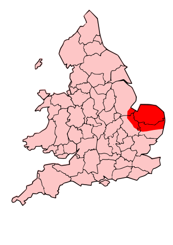
English: A map showing the territory of the Iceni tribe overlayed in red in the context of the modern county boundaries of England and wales
|
| Date | 2009-10-24 19:28 (UTC) |
| Source |
|
| Author |
|
| This is a retouched picture, which means that it has been digitally altered from its original version. Modifications: Revised to show extent of Iceni Territory. The original can be viewed here: Map_of_the_Territory_of_the_Dobunni.svg. Modifications made by Jpb1301.
|
| This file is licensed under the Creative Commons Attribution-Share Alike 3.0 Unported license. | ||
|
File usage
The following pages on Schools Wikipedia link to this image (list may be incomplete):
Metadata
Wikipedia for Schools...
SOS Childrens Villages has brought Wikipedia to the classroom. SOS Children's Villages believes that a decent childhood is essential to a happy, healthy. Our community work brings families new opportunities through education, healthcare and all manner of support. You can help by sponsoring a child.