
File:Cyprus SBAsInRed.png
Cyprus_SBAsInRed.png (630 × 321 pixels, file size: 9 KB, MIME type: image/png)
| |
This is a file from the Wikimedia Commons. Information from its description page there is shown below.
Commons is a freely licensed media file repository. You can help. |
 |
This map image could be recreated using vector graphics as an SVG file. This has several advantages; see Commons:Media for cleanup for more information. If an SVG form of this image is already available, please upload it. After uploading an SVG, replace this template with {{ vector version available|new image name.svg}}. |
| Description |
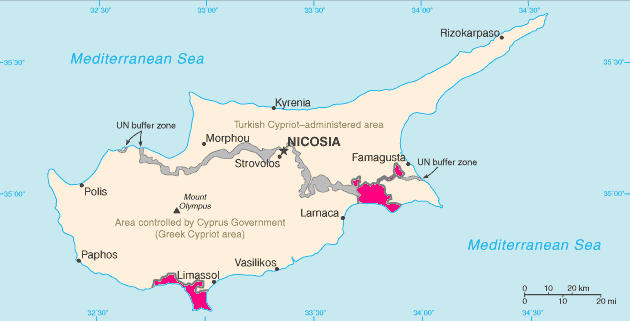
English: Map of Cyprus with WSBA and ESBA in pink, the traditional colour on maps for British possessions. The map is adapted from the CIA World Factbook map.
Español: Situación de Acrotiri (en el sur) y Dhekelia (en el este).
Français : Carte de Chypre avec Acrotiri au sud et Dhekelia à l'est. Cette carte est tirée du CIA World Factbook
Magyar: Akrotíri (nyugaton) és Dekélia (keleten) elhelyezkedése Ciprus szigetén.
Русский: Территории Акротири и Декелии выделены красным цветом.
|
|||
| Date | 1 May 2005 (original upload date) | |||
| Source | CIA World Factbook https://www.cia.gov/library/publications/the-world-factbook/geos/dx.html | |||
| Author | CIA, Hoshie | |||
| Permission ( Reusing this file) |
|


File usage
The following pages on Schools Wikipedia link to this image (list may be incomplete):
About Schools Wikipedia
Wikipedia for Schools is one of SOS Childrens Villages' many educational projects. In 133 nations around the world, SOS Children works to bring better education and healthcare to families in desperate need of support. Have you heard about child sponsorship? Visit our web site to find out.