 |
This is a file from the Wikimedia Commons. Information from its description page there is shown below.
Commons is a freely licensed media file repository. You can help.
|
| Description |
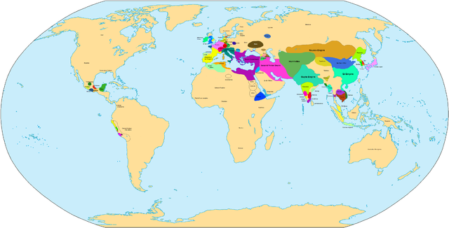
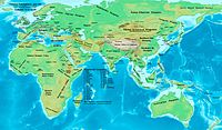
Main states in 500 CE |
| Date |
20 May 2007 |
| Source |
Own work |
| Author |
Javierfv1212 |
| Maps of world history |
| BC |
2000 · 1000 · 500 · 400 · 323 · 300 · 200 · 100 · 50
|
|
| AD |
1 · 50 · 100 · 200 · 250 · 300 · 400 · 500 · 700 · 750 · 820 · 900 · 1959 · 1980 ·
|
|
|
Maps of colonization history
1492 · 1550 · 1660 · 1754 · 1800 · 1822 · 1885 · 1898 · 1914 · 1920 · 1936 · 1938 · 1945 · 1959 · 1974 · 2007
|
|
|
see also: Eastern Hemisphere only maps template (1300BC-1500AD)
|
| (this template: · view · discuss ) |
|
I, the copyright holder of this work, hereby publish it under the following license:
|
| Annotations |
This image is annotated: View the annotations at Commons |
|
|
1681
156
2081
1486
4000
2036
File usage
The following pages on Schools Wikipedia link to this image (list may be incomplete):
This selection has made Wikipedia available to all children. The world's largest orphan charity, SOS Childrens Villages brings a better life to more than 2 million people in 133 countries around the globe. There are many ways to help with SOS Childrens Villages.


